|
|||||||||
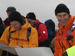
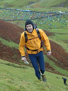
  A Mountain Marathon is a two day, mountain orienteering race. Several are organised in the UK each year but the most well known is the OMM, previously known as the KIMM or Karrimor International Mountain Marathon The race is run at the end of October, attracting interesting weather, and takes place in a different part of the country each year, announced a couple of months before. A Mountain Marathon is a two day, mountain orienteering race. Several are organised in the UK each year but the most well known is the OMM, previously known as the KIMM or Karrimor International Mountain Marathon The race is run at the end of October, attracting interesting weather, and takes place in a different part of the country each year, announced a couple of months before.
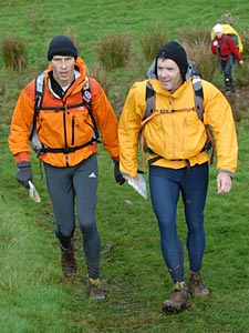
You compete in pairs and can enter a variety of courses. There is a choice of 7 courses, 4 following a set series of control points over approximately 80, 65, 50 and 40km. Alternatively you can follow one of 3 score course where you have to visit controls to accumulate points; the long score is 13hrs over 2 days, the Medium 11 hrs and the Short 9 hrs. After several years competing over the 50km (B) Course we have switched to the Medium Score. In each course you compete against about 200 to 280 other teams. |
|||||||||
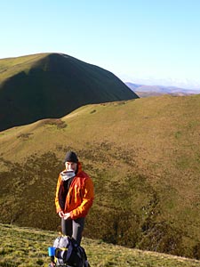
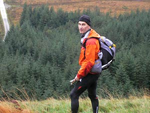 So what do you need to do a Mountain Marathon? Essentials include fell running kit including bad weather gear, tent, food for 36hrs, cooking gear, sleeping bag, head torch, compass (no GPS), rucsac, first aid kit and bivi bag. The principle is that as a team you must be self sufficient for the length of the race. How 'lightweight' you go is a matter of choice, but it can get v wet and windy. So what do you need to do a Mountain Marathon? Essentials include fell running kit including bad weather gear, tent, food for 36hrs, cooking gear, sleeping bag, head torch, compass (no GPS), rucsac, first aid kit and bivi bag. The principle is that as a team you must be self sufficient for the length of the race. How 'lightweight' you go is a matter of choice, but it can get v wet and windy.
We pack our gear into a 30-35l sack. We take a tent that we can get into comfortably (2.2kg Lightwave), Therm-a-rest sleeping mats, some dry clothes and down bags in a dry bag, and dried rations (pretty disgusting but light and come on, you are not going to get haut cuisine up there). Hard men take tiny tents (aka polytunnel), micro sleeping bag, no mat, no spare clothes, titanium tent pegs and they cut down the handle of their toothbrush to save weight! Cold and miserable if you ask me. Luxuries include mini radio/iPod for tent, crossword puzzles, chocolate, whisky night cap etc.. one year I saw a guy packing a cooked chicken! |
|||||||||
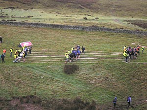  The start is staggered with teams from each course going off at 1 minute intervals. You get your map 1 minute before the start. This is the first chance to see where the sadistic organisers are going to send you and it is essential to spend several minutes studying the options and making a plan, particularly if you are doing a Score Class race. The start is staggered with teams from each course going off at 1 minute intervals. You get your map 1 minute before the start. This is the first chance to see where the sadistic organisers are going to send you and it is essential to spend several minutes studying the options and making a plan, particularly if you are doing a Score Class race. |
|||||||||
 The maps are laminated 1:40,000, OS Explorer type maps, specially made for the event. The maps are laminated 1:40,000, OS Explorer type maps, specially made for the event.
Distances are further than you think if you are used to 1:25,000 so you need to work your way carefully into the map if you are not going to get lost. The golden rules are to use features of the hillside to help you to navigate and believe what you see around you. If you are by a fence, close to a steep drop that must correspond to a point on the map, even if it is not where you think you are! |
|||||||||
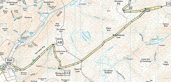
| In the example above we decided to visit AB, CO and CH as our first three controls. Instead of going straight up the hill from the start we choose to follow a footpath, then another which climbed the hill. As well as being less steep, and quicker underfoot we can see that it will lead us into the stream where AB is located. From there we see that we can contour the hillside to reach CO and then use the fence that runs for 1.5km followed by the trig point on top of Roger Law to find CH. These 'handrails' are essential as it is thick fog on the tops. | |||||||||
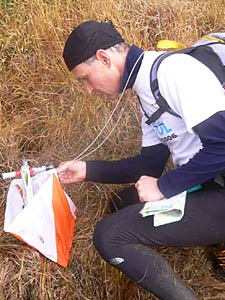 The next challenge is to find the controls. The map tells you what you are looking for: The next challenge is to find the controls. The map tells you what you are looking for:
some descriptions are straightforward, hill top, stream junction, wall S side, footbridge E side. More tricky is the 'reentrant' - a dip in the hillside. In the fog you can find dips everywhere. Also watch out for the "crag foot" - you might think that a control is on top of a hill when in fact it is 20m further down. Again the best way to find a control - if you can't see it from afar - is to take a bearing from something you can find; a wall bend or junction, trig point, river junction or whatever. So how do you know how much you can run in 6 hours across Scottish mountainside? On day 1 of the OMM 2007 we covered 25km and 1500m of ascent in 5 1/2 hours - only 4.5 km/hr. This still got us into the top 30 places. There were few footpaths and a lot of heather and open country. On day 2 we used more tracks and again covered 25km and 1200m of ascent - now 5.5km/hr. A piece of string marked out at an estimate of your speed helps you to plan a score class route and avoid being overambition in reaching all those 50 point controls in the far corners of the map! |
|||||||||
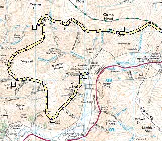 The estimate of what you can cover still won't be perfect. The map on the left shows how you can build contingency into your route. We are approaching the finish from the East and have seen 5 controls in mountainous terrain around the midway camp. If pushed for time we can pick off one or two and then head for camp. If we are going well we can pick up every control. The estimate of what you can cover still won't be perfect. The map on the left shows how you can build contingency into your route. We are approaching the finish from the East and have seen 5 controls in mountainous terrain around the midway camp. If pushed for time we can pick off one or two and then head for camp. If we are going well we can pick up every control.
In fact we do get every control and still complete with 30 mins to spare. However we could have struggled in the fog and cut it much more fine. There is nothing more frustrating than slogging up a hill to get 30 points and then losing them when you arrive 15 minutes after the finish time. Last essential guide is to find the quickest route, not the shortest. On day two we make a diversion to follow the Southern Upland Way for several km. This was very fast going and we made much better time than we would have done slogging across the heather. |
|||||||||
 So if you like the outdoors, enjoy running and don't mind getting muddy then a LAMM or OMM is a great experience. And don't be put off by Richard Askwith's great description in his brilliant book "Feet in the Clouds": So if you like the outdoors, enjoy running and don't mind getting muddy then a LAMM or OMM is a great experience. And don't be put off by Richard Askwith's great description in his brilliant book "Feet in the Clouds":
"I'm lying in a puddle in a field in Scotland, an icy wind screaming overhead. I'm caken from head to foot in sweat and mud, despite having spent five minutes in a freezing river, fully clothed, trying to rinse the worse of it off - followed by quarter of an hour standing in the wind, arms spread like a cormorant's wings, trying to get vaguely dry. The nearest hot tap is probably 20 miles away. But at least Lewis and I have managed to get our tiny tent up; and, although liquid mud from the waterlogged field is already seeping through the door, we're a great deal warmer and drier than we have been all day. We are also not running, which, to be honest, is all that really matters. Instead we're lying in the tent, sharing an ex-fruitcake that has been battered back into its constituent parts, and washing it down with some minestrone Cup-o'-Soup from a shared mug that still carries the flavour of that morning's tea. It is, by some distance, the most delicious meal I have ever tasted." happy running... |